Garmin TopoActive map West Europe v2.02
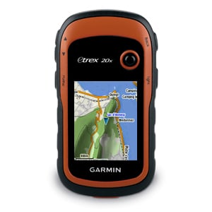
This map is preloaded in new eTrex 20x.
Garmin TopoActive map supports and enhances a range of outdoor activities, such as hiking, geocaching, cycling, mountaineering and fishing.
The new Garmin TopoActive map of Western Europe, a perfect starting point for your first recreational activity with GPS. The map it's routable and shows elevation changes. Garmin
TopoActive Western Europe covers the following 23 countries: Andorra, Austria, Belgium, Denmark, Finland, France, Germany, Iceland, Ireland, Italy, Liechtenstein, Luxembourg, Malta, Monaco, Netherlands, Norway, Portugal, San Marino, Spain, Sweden, Switzerland, United Kingdom, Vatican City.
Garmin ActiveMap is based on OSM mapping data, map quality depends heavily on local mapping coverage, Garmin cannot guarantee the quality and completeness of mapping data.
FID 3746
GMapTool log
/gmapprom.img, length 3509190656
Header: 11.05.2015 10:06:16, DSKIMG, XOR 00, V 2.02, Ms 0, 006-D5639-00
Mapset: Garmin TopoActive West Europe
fat: 1000h - 1200h - B0000h, block 65536
maps: 688, sub-files 1374
Sub-file fat length
00003746 MDR 1200h 13423883
00003746 SRT 1400h 154286
I101B93E GMP 1600h 14475621
GMP: TRE RGN LBL NET NOD DEM
map 101b93e (16890174)
date 03.02.2015 15:08:02
priority 20, parameters 1 4 9 13
levels [15,16,17,18,20,22,24], zoom [86,85,84,3,2,1,0]
N: 42.816081, S: 41.717277, W: 2.091522, E: 3.213201
GARMIN OSM Europe
Copyright 1995-2015 by GARMIN Corporation.
CP 65001, UTF8
DEM layers: 4, N: 42.816412, W: 2.091226
I101B93E SRT 1800h 154286
I101B93F GMP 1A00h 967694
GMP: TRE RGN LBL NET NOD DEM
map 101b93f (16890175)
date 03.02.2015 08:01:40
priority 20, parameters 1 4 9 13
levels [17,18,20,22,24], zoom [84,3,2,1,0]
N: 53.180008, S: 52.704763, W: 0.969887, E: 2.054143
GARMIN OSM Europe
Copyright 1995-2015 by GARMIN Corporation.
CP 65001, UTF8
DEM layers: 4, N: 53.180098, W: 0.969409
I101B93F SRT 1C00h 154286
I101B940 GMP 1E00h 4362934
GMP: TRE RGN LBL NET NOD DEM
map 101b940 (16890176)
date 03.02.2015 15:04:10
priority 20, parameters 1 4 9 13
levels [16,17,18,20,22,24], zoom [85,84,3,2,1,0]
N: 51.606088, S: 50.507283, W: 0.969887, E: 2.091565
GARMIN OSM Europe
Copyright 1995-2015 by GARMIN Corporation.
eTrex 20x Homepage
https://buy.garmin.com/en-GB/GB/sports-recreation/handhelds/etrex-20x/prod518046.html